DOMINION BOULEVARD CORRIDOR STUDY | Chesapeake, Virginia
88 | Area Plans
Area Plans | 89
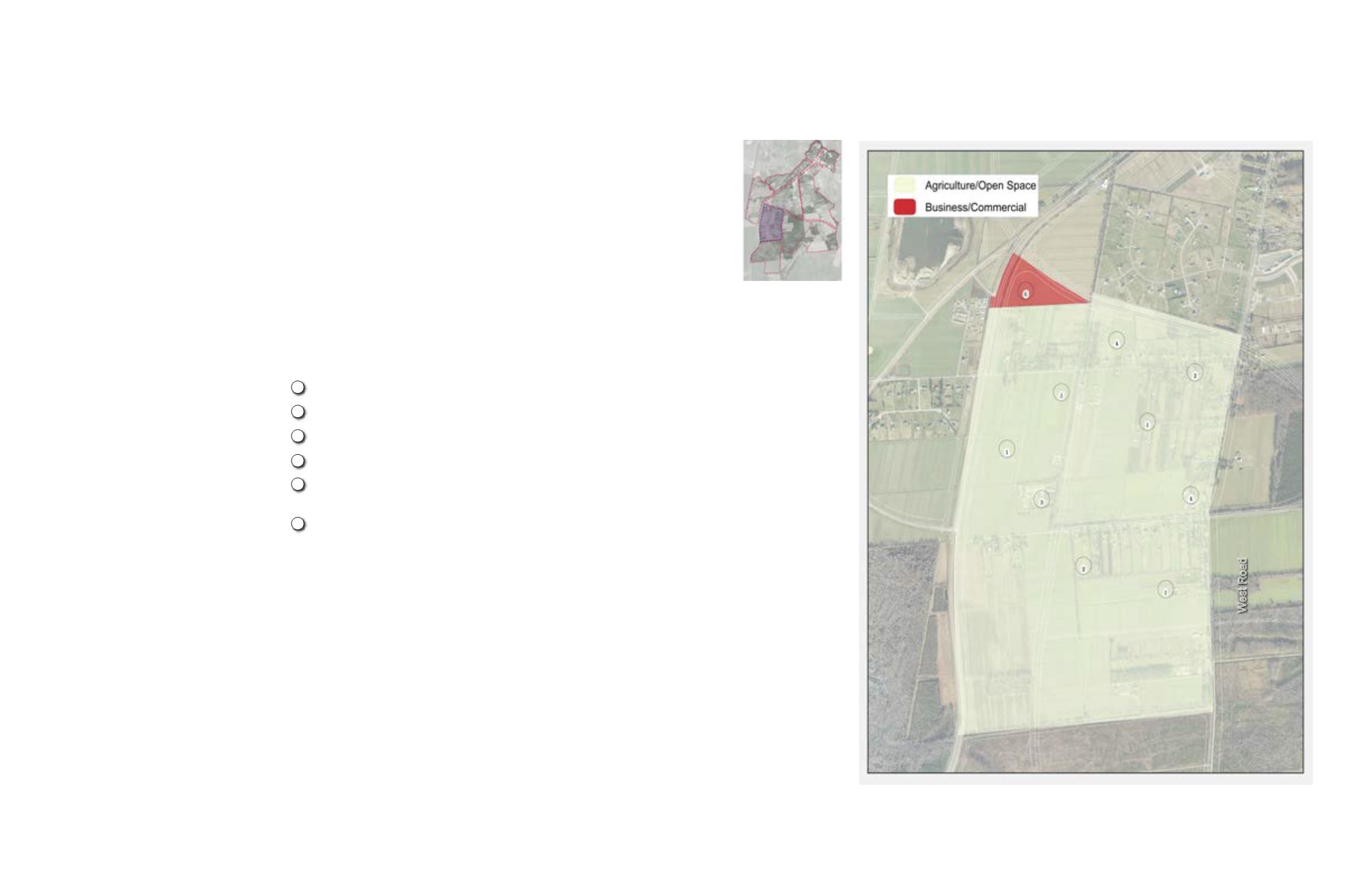
Figure 65: Area 7 enlargement
Figure 64: Area 7
location
Area 7: West Road -
Size:
921 Gross Acres
Existing Condition:
Access - Area 7 is located adjacent to
Dominion Boulevard but does not have an
existing intersection on that roadway. The
Area currently is accessed off of West Road
that extends from the north through Area 5.
Land Use - The predominant existing land
use is large patches of productive agriculture
and low density rural subdivisions along the
Herring Ditch.
Environmental Features – Most of the land
is in agricultural use. The Herring Ditch
provides an interesting environmental
feature and potential amenity.
Utilities - water is available to portions of the
Area. Sewer is not available
Opportunity:
Given the large proportion of pure
agricultural use, this Area is primed for
Agricultural Preservation, which includes a
provision to cluster any new development
and to avoid the allowance for 3 acre lots
that do not promote agricultural preservation
or character.
Threat:
Unless a program for developing in
Agricultural land is developed that clusters
development on a smaller footprint, this
land will most likely become 3 acre lot
subdivisions that do not effectively support
agriculture.
New Land Uses in Area Plan:
Residential Uses
Rural Cluster
Non Residential Uses
Urban Mixed Use
Business/ Commercial
Open Space Uses
Agriculture / Conservation
180 units
8,890 bldg. sq. ft.
240,030 bldg. sq. ft.
445 acres
Preserving agriculture & rural lifestyle
Other Special Considerations:
Creating new standards and requirements for rural development that
will likely be impacted by a more urbanizing growth pattern in this
Area enhance the community’s ability to preserve agriculture and
a rural way of life. It is recommended that residential development
be consolidated into small clusters that preserve land rather than
allowing for large lots that don’t effectively support agriculture as
described in “Rural by Design: Maintaining Small Town Character”
by Arendt, Brabec, Reid and Yaro published by the American
Planning Association 1994. Non residential development should
be oriented toward Route 17 and its proposed intersection with the
future Pleasant Grove Parkway.
West Road
2035 Comprehensive Plan Designations:
• Agriculture / Open Space
• Conservation
• Government / Institution
Existing productive agricultural lands are preserved
Existing rural lots
Existing City training facility
Crossroads are perfect for farm stands or neighborhood retail.
The Herring Ditch provides a greenway connection that links
to the east and to the north.
Transportation Oriented Business/ Commercial
1
2
3
4
Features of the Proposed Area Plan (see plan):
5
6


