DOMINION BOULEVARD CORRIDOR STUDY | Chesapeake, Virginia
104 | Infrastructure Strategy
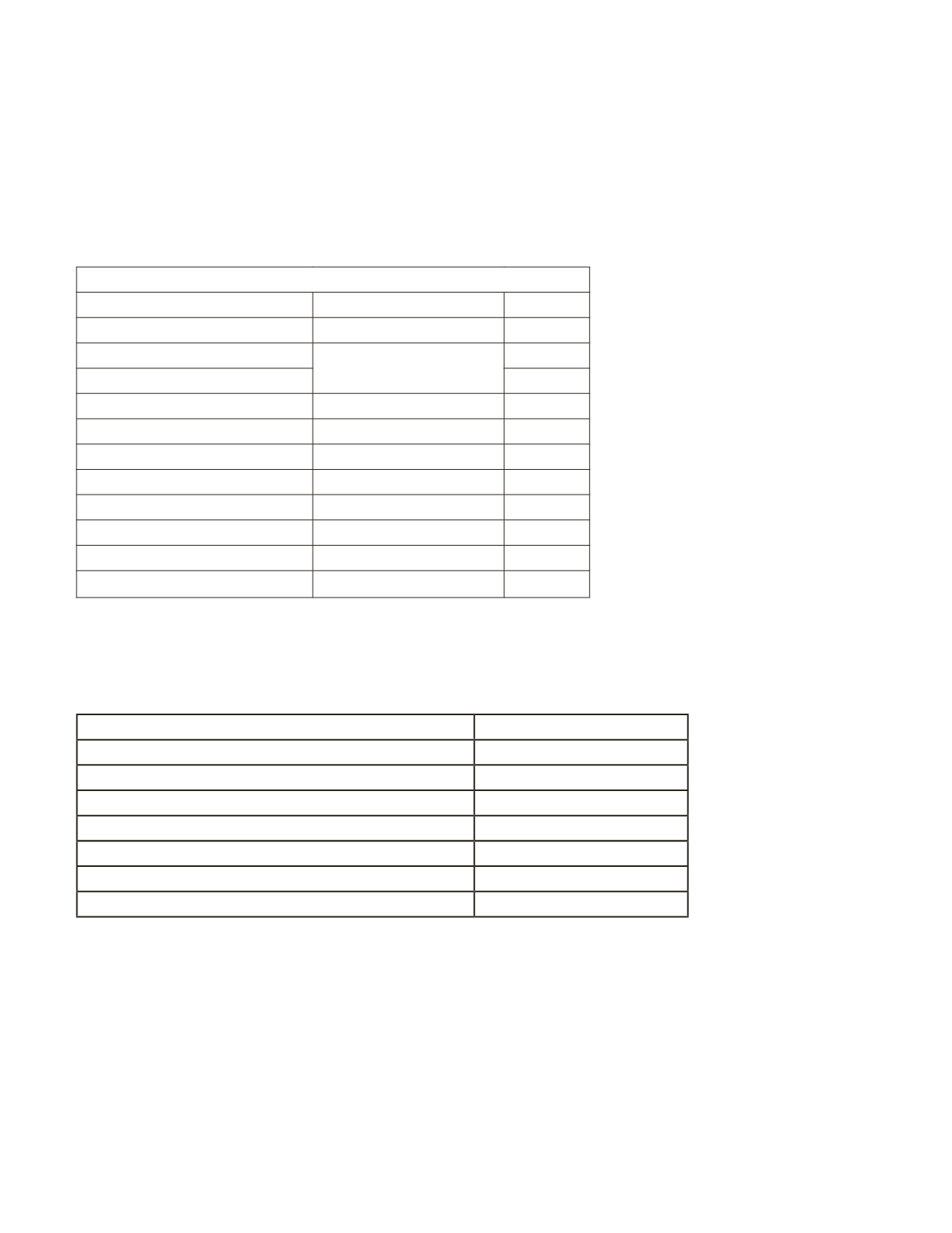
The 2014 and 2034 ADT volumes that are N/A means that no background traffic data
could be found on these roadway segments and therefore no volumes were utilized other
than the trip generation volumes. The projected traffic volumes where distributed across
the proposed roadway network based upon the land use patterns, and modeled. The
anticipated Level of Service was determined utilizing the 2034 projected ADT volumes, and
are shown in the following table.
Projected 2034 Build Capacity Analysis
Limits
Corridor
LOS
South of Cedar
Dominion Blvd
C
East of Dominion Blvd
Cedar Rd
N/A
South of Moses Grandy Trail
A
West of Dominion Blvd
Moses Grandy Trail
C
East of Dominion Blvd
Grassfeld Pkwy
A
South of Dominion Blvd
Shillelagh Rd
C
South of Dominion Blvd
Scenic Pkwy
B
South of Dominion Blvd
West Rd
C
South of Dominion Blvd
Pleasant Grove Pkwy C
South of Cedar Rd
Cahoon Pkwy
B
George Washington Hwy B
The following table represents the intersection level of service based upon the projected
2034 build volumes and the Parsons Brinkerhoff Synchro model.
Intersection
2034 PM Peak Hour LOS
Dominion Blvd & Cedar/Moses Grandy Trail
D
Dominion Blvd & Grassfeld Pkwy
D
Dominion Blvd & Scenic Pkwy
D
Dominion Blvd & Pleasant Grove Pkwy
D
Dominion Blvd & George Washington Hwy
D
Cedar Rd & Cahoon Pkwy
D
Moses Grandy Trail & Cedar Rd
D
Table 11: Projected build capacity
Table 12: Projected level of service


