DOMINION BOULEVARD CORRIDOR STUDY | Chesapeake, Virginia
68 | Planning Frameworks
In the Parking Lot
Reducing the amount of impervious surface
contributes greatly to reducing the amount
of site area needed for water management.
Using permeable paving techniques are
becoming more and more cost effective,
especially when one considers the savings
in site area that can be provided. The
landscape of the parking lot can become
part of the water quality system as well. The
use of rain gardens between rows of parking
lots and within the parking islands creates a
softening landscape while doubling up the
use of the space for water management and
beautification. Edges of parking lots can be
used for larger infiltration basin landscapes.
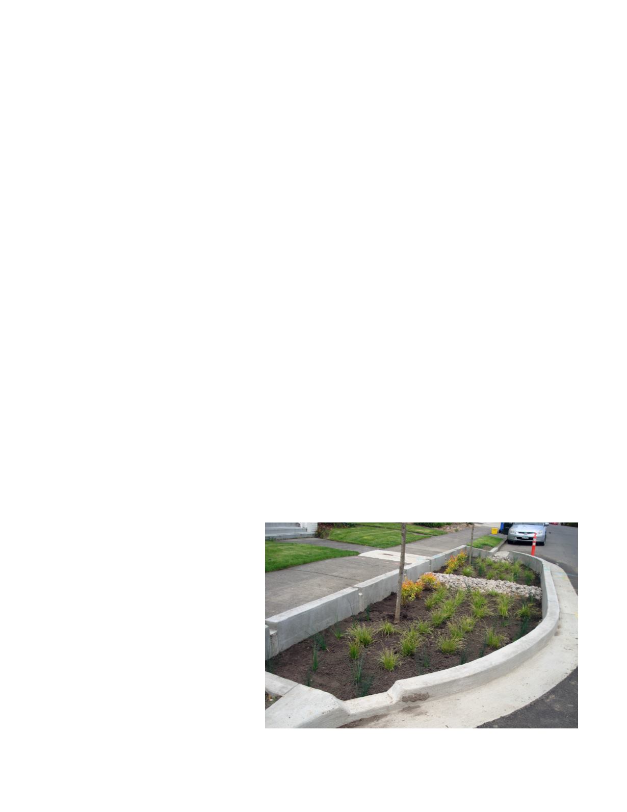
In the Street
Reducing the amount of pavement
contributes to reducing the amount of water
that needs to be managed. Locating canals,
bioswales and infiltration trenches as part
of the roadway edges provides water quality
management next to the roadway, while
also providing an interesting and naturalized
landscape for the street. This naturalized
system can also reduce the size or amount
of costly pipes located under the ground.
Within Parks and Open Spaces
The parks and open spaces of the district
or neighborhood can be planned for
both recreation and water management.
Neighborhood or community scaled ponds,
canals, constructed wetlands and bio-
retention areas can be located to serve a
sub watershed.
Within Powerline Easements
With the permission of the easement right of
way holders, the large power line easements
that traverse the Study Area can be used
for water quality BMP’s and along with
trails, can become part of the master plan’s
greenway network.
The Existing Canals
As much as possible, neighborhoods and
roadways should align with the existing
canals so that they can be used within the
overall greenway network and provide an
additional place for trails.
All of the above strategies, once connected
and celebrated, will provide a landscape for
the project that promotes habitat; provides a
greenway network that links neighborhoods
to each other; and establishes an ethic for
the project that is consistent with the vision
for the project.
The street and greenway cross sections
provided for the Master Plan describes
the location of stormwater management
landscapes. The Master Plan also describes
locations where canals and forested areas
should be protected and preserved. The
Master Plan also locates open space areas
within the districts and neighborhoods that
are available for use for neighborhood
scaled water management ponds or
landscapes.
Each developer within the project will
be responsible for managing its post
development water “on site” and within the
distribution networks provided within the
streets. The large neighborhood scaled
water management areas may be used to
offset onsite management subject to policies
established by the City of Chesapeake and
any other laws applicable to stormwater
management.
Example of rain garden within street used for water quality


